Ground-based and airborne measurement techniques are applied to study the interaction of atmospheric radiation with clouds and the Earth‘s surface. For that purpose, imaging and non-imaging spectrometers are used for remote sensing applications and to quantify the radiation energy budget. Radiative transfer models represent our major tool to interprete our measurements and to improve retrievals of cloud and surface parameters.
Current research projects
The following projects are sub-projects in joint projects of the German Research Foundation (DFG) and the Federal Ministry of Education (BMBF).

Arctic Amplification: Climate Relevant Atmospheric and Surface Processes, And Feedback Mechanisms
Funding: German Research Foundation
Period: 01.01.2016 – 31.12.2027
Planet Earth has warmed on average by 0.87 K over the past 150 years. In the Arctic, the warming is much stronger, which became most prominent over the last decades. Currently, the Arctic warming exceeds the increase of near-surface air temperature in the mid-latitudes by about 2 K. This phenomenon is commonly referred to as Arctic amplification.

- Subproject A02: Tethered balloon-borne energy budget measurements in the cloudy central Arctic
Team: Prof. Dr. Manfred Wendisch (PI), Fan Wu
- Subproject A03: Impact of low-level clouds and surface conditions on Arctic atmospheric boundary layer turbulence and radiation
Team: Dr. Michael Schäfer (PI); Joshua Müller
- Subproject B03: Characterization of Arctic mixed-phase clouds by airborne in-situ measurements and remote sensing
Team: Dr. André Ehrlich (PI) Dr. Marcus Klingebiel
- Subproject C01: Influence of spatial heterogeneity and temporal evolution of surface properties on radiative energy fluxes in the coupled atmosphere-sea ice-ocean system
Team: Dr. Evelyn Jäkel (PI); Patrizia Schoch
- Subproject Z01: Central services, administration and coordination
Team: Prof. Dr. Manfred Wendisch (PI), Dr. Marlen Brückner, Simone Lindemann
- Subproject Z02/IRTG: Integrated Research Training Group
Team: Prof. Dr. Manfred Wendisch, Dr. Marlen Brückner,
Atmospheric and Earth System Research with the "High Altitude and longe Range Aircraft (HALO)"
Funding: German Research Foundation
Period: 09.05.2016 – 31.12.2027
Team: Prof. Dr. Manfred Wendisch, Dr. Mareike Heckl, Dr. Anja Schwarz
Our group is coordinating the DFG Priority Program: HALO-SPP 1294 on "Atmospheric and Earth System Research with HALO". The HALO-SPP supports research of atmospheric and Earth system related processes. HALO is a Gulfstream G-550 aircraft specifically equipped with numerous in situ and remote sensing instruments. It brings scientists together who work in a wide range of disciplines including physics, chemistry, meteorology, geosciences, mathematics, informatics, engineering and others to maximize the scientific output and to carry out multi-disciplinary research.
Details on the HALO-SPP are provided on the HALO-SPP-web pages
Aims
Our scientific aim using HALO is to investigate the radiative effects of different clouds regimes. We operate spectral solar remote sensing instruments including the SMART-Albedometer, which allows to measure solar spectral up- und downward irradiances to quantify for example cloud radiative effects. More recently, we deployed a new thermal-infrared imager in cooperation with the MPI Hamburg. This imager enables investigations on the spatial distribution of liquid water and ice in clouds, but also on the spatial variability of Arctic surface properties during the upcoming HALO-(AC)3 campaign in 2022.

Subproject: Characterizing the evolution of the radiative forcing of shallow and deep convective clouds throughout their life cycle by combining airborne and satellite observations in the tropical Atlantic Ocean
Period: 15.02.2024 – 14.02.2027
Team: Dr. André Ehrlich, Dr. Anna Lübke
The interaction of clouds with solar (shortwave) and terrestrial (longwave) radiation is a complex and central component of the Earth’s radiative energy budget. Clouds may heat or cool the sub-cloud atmosphere by reflecting and absorbing solar radiation while simultaneously absorbing and emitting terrestrial radiation. By this, clouds modify the climate system and drive atmospheric circulation and subsequent feedbacks. However, this is dependent on a number of cloud characteristics (e.g., Chen et al., 2000, Luebke et al., 2021).
The EUREC4A campaign in 2020 already observed shallow convective clouds in the trade-wind region at the edge of the ITCZ, and resulted in work characterizing how different cloud properties impact their radiative effects (Luebke et al., 2021). The work proposed here seeks to extend this study by considering the life cycle of convective clouds. In addition to shallow cumulus, DCC within and at the edge of the Atlantic ITCZ will be analyzed. The core objective is to quantify the changes in the radiative forcing of trade-wind clouds and DCC during their life cycle as a function of the evolution of the cloud macrophysical and microphysical properties and to test the hypothesis that cloud macrophysical properties dominate the cloud radiative forcing in the early stages of the cloud lifetime, whereas microphysical properties become more important in mature stages.
Project: Remote sensing and radiative forcing of inhomogeneous trade wind cumuli
Period: 01.09.2019 – 31.12.2024
Team: Prof. Dr. Manfred Wendisch, Dr. André Ehrlich, Dr. Anna Lübke, Dr. Michael Schäfer
The main focus of the project is the quantification of the large scale radiative effect of trade wind cumuli as a function of the macro- and microphysical cloud properties, the spatial distribution of these clouds, and the mesos-scale vertical motion. The measurements were conducted during the EUREC4A (ElUcidating the Role of Cloud-Circulation Coupling in ClimAte) campaign east of Barbados in February 2020. They include first observations with the new multi-channel thermal-infrared imager and a new set of solar and thermal broadband radiation sensors.

Project: Influence of ice crystal shape on the radiation effect of Arctic cirrus: measurements and representation in numerical weather prediction models
Periond 01.02.2021 – 31.01.2024
Team: Prof. Dr. Manfred Wendisch, Dr. André Ehrlich, Johannes Röttenbacher
The parametrization of radiative properties of ice cloud particles affects the output of the radiation scheme in the output of the radiation scheme ecRad, which is applied in the ECMWF Integrated Forecast System (IFS). The analysis of the radiation budget for Arctic cirrus needs to be extended to the thermal-infrared spectral range, since its fraction is enhanced compared to the solar contribution. The project is connected to the upcoming HALO missions Cirrus-HL (High Latitude) und HALO-(AC)3. Measurements by the new broadband radiation system, a new thermal-infrared imager, and the SMART-albedometer will be used to characterize the radiation budget above and below the high latitude cirrus. It will be analyzed, how the high reflecting sea ice and the persistent low-level clouds influence the radiative effect of Arctic cirrus. Further, it will be investigated by means of a systematic comparison with measurements, how the radiative effects are represented in numerical weather forecast models.
Previous research projects
The following projects were funded by the German Research Foundation (DFG) and the European Union (EU).
MOSAiC - ALIBABA: Application of airborne ice surface and radiation data based on MOSAiC observations for surface albedo parameterizations of the central Arctic (ALIBABA)
Funding: Federal Ministry of Education and Research
The impact of climate change is most significant in the Arctic. Here, drastic changes in the climate and ecosystem have taken place in recent decades. To understand this new climate state and its future development, a large international measurement campaign was initiated by the Atmosphere Working Group of the International Arctic Science Committee (IASC) in 2011. The initiative has been expanded across several disciplines and is being run under the title "Multidisciplinary drifting Observatory for the Study of Arctic Climate" (MOSAiC). The core of MOSAiC was an intensive one-year observation and measurement programme based on the research icebreaker Polarstern as a drifting station, which was successfully completed in October 2020.

Project: Parametrization of the Arctic surface albedo for climate models
Period: 01.11.2020 – 29.02.2024
Team: Prof. Dr. Manfred Wendisch, Dr. Evelyn Jäkel, Tim Sperzel, Dr. Khalil Karami
Within the frame of the MOSAiC - Expedition the the helicopter-borne meteorological sonde HELiPOD, operated by TU Braunschweig, delivered data of the spatial variablity of atmospheric parameters, sea ice surface properties, as well as solar and thermal radiation measurements. The ALIBABA project aims to use these versatile measurements to improve the albedo parametrization of Arctic surfaces in climate models depending on the ice properties and atmospheric conditions. So far, the complex interactions between clouds and the highly variable Arctic surface types are not well considered in the current models.
Typical spatial scales of regional climate models and satellite observations, ranging between 250 m and 10 km, are taken into account. The surface reflections properties for these spatial scales mostly represent a mixture of different surface types. For this reason three-dimensional (3D) radiative transfer simulations are combined with measurements of these complex surface reflection properties to estimate the contribution of the individual parameters.
Arctic Amplification: Climate Relevant Atmospheric and Surface Processes, And Feedback Mechanisms
Funding: German Research Foundation
Period: 01.01.2016 – 31.12.2019
Planet Earth has warmed on average by 0.87 K over the past 150 years. In the Arctic, the warming is much stronger, which became most prominent over the last decades. Currently, the Arctic warming exceeds the increase of near-surface air temperature in the mid-latitudes by about 2 K. This phenomenon is commonly referred to as Arctic amplification.

Project: C02 – Interactions of snow on sea ice with atmospheric constituents including black carbon
Team: Dr. André Ehrlich, Tobias Donth, Dr. Evelyn Jäkel
Results of the study on the solar radiative effects of black carbon
Donth, T., Jäkel, E., Ehrlich, A., Heinold, B., Schacht, J., Herber, A., Zanatta, M., and Wendisch, M., 2020: Combining atmospheric and snow radiative transfer models to assess the solar radiative effects of black carbon in the Arctic, Atmos. Chem. Phys., 20, 8139–8156, doi:10.5194/acp-20-8139-2020.

Atmospheric and Earth System Research with the "High Altitude and longe Range Aircraft (HALO)"
Funding: German Research Foundation
Our group is coordinating the DFG Priority Program: HALO-SPP 1294 on "Atmospheric and Earth System Research with HALO". The HALO-SPP supports research of atmospheric and Earth system related processes. HALO is a Gulfstream G-550 aircraft specifically equipped with numerous in situ and remote sensing instruments. It brings scientists together who work in a wide range of disciplines including physics, chemistry, meteorology, geosciences, mathematics, informatics, engineering and others to maximize the scientific output and to carry out multi-disciplinary research.
Details on the HALO-SPP are provided on the HALO-SPP-web page.
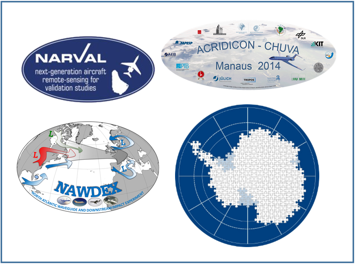
Project: A contribution to HALO campaigns NARVAL-II and NAWDEX
Period: 2016 – 2020
Team: Dr. Kevin Wolf, Prof. Dr. Manfred Wendisch
Results of the project:
- Wolf, K., A. Ehrlich, M. Mech, R. J. Hogan, and M. Wendisch, 2020: Evaluation of ECMWF Radiation Scheme Using Aircraft Observations of Spectral Irradiance above Clouds, J. Atmos. Sci., 77 (8) , 2665–2685 , DOI:10.1175/JAS-D-19-0333.1
- Wolf, K., A. Ehrlich, M. Jakob, S. Crewell, M. Wirth, and M. Wendisch, 2019: Improvement of Airborne Retrievals of Cloud Droplet Number Concentration of Trade Wind Cumulus Using a Synergetic Approach, Atmos. Meas. Tech., 12 , 1635-1658 , DOI:10.5194/amt-12-1635-2019

Project: ACRDICON - Aerosol, Cloud, Precipitation, and Radiation Interactions and Dynamics of Convective Cloud Systems
Period: 2010 – 2017
Team: Prof. Dr. Manfred Wendisch, Dr. André Ehrlich, Dr. Evelyn Jäkel, Dr. Trismono C. Krisna
An extensive airborne/ground-based measurement campaign to study tropical convective clouds was performed in the Amazon rainforest in 2014. The project combined the joint German-Brazilian ACRIDICON (Aerosol, Cloud, Precipitation, and Radiation Interactions and Dynamics of Convective Cloud Systems) and CHUVA projects. ACRIDICON aimed at the quantification of aerosol-cloud-precipitation interactions and their thermodynamic, dynamic and radiative effects in convective cloud systems by in-situ aircraft observations and indirect measurements (aircraft, satellite, and ground-based).
The HALO aircraft was equipped with remote sensing and in-situ instrumentation for meteorological, trace gas, aerosol, cloud, and precipitation measurements. Five mission objectives were pursued: (1) cloud vertical evolution (cloud profiling), (2) aerosol processing (inflow and outflow), (3) satellite validation, (4) vertical transport and mixing (tracer experiment), and (5) clouds over forested and deforested areas. The five cloud missions collected data in clean atmospheric conditions and in contrasting polluted (urban and biomass burning) environments.
- A campaign overview is given in BAMS:
Wendisch, M., et al.: The ACRIDICON-CHUVA campaign: Studying tropical deep convective clouds and precipitation over Amazonia using the new German research aircraft HALO, B. Am. Meteorol. Soc., 97, 1885–1908, 2016.: - Further results of the project are published in the AMT/ACP Special Issue

Antarctic research with comparative studies in Arctic ice regions
Funding: German Research Foundation
The priority program uses a multidisciplinary approach to study the complex interactions in the Earth system, to contribute significant insights to understanding the changes in the past, present and future. This is achieved by focusing on four interdisciplinary major research topics: “Linkages with Lower Latitudes", "Dynamics of Climate System Components", "Response to Environmental Change“ and “Improved Understanding of Polar Processes and Mechanisms”. The logo, showing a puzzle shaped like the Antarctic continent and the adjacent ocean, symbolizes the multidisciplinary approach, where all pieces fit together.
Project: Coupling of airborne and in situ-graound base measurementsof surface albedo, BRDF and snow properties in Antarctica to improve prognostic snow models
Period: 2014 – 2017
Team: Prof. Dr. Manfred Wendisch, Dr. Tim Carlsen, Dr. André Ehrlich, Dr. Michael Schäfer
Surface albedo is one of the most important factors determining near-surface energy fluxes. Snow and ice represent the surfaces with the highest albedo on Earth. This multiplies their impact on the radiative energy budget. All the same, changes in snow grain size, surface roughness or atmospheric parameters such as cloud cover cause high spatial and temporal variability in snow surface albedo and therefore lead to local changes of the radiative energy budget. Consequently, it is of great interest to incorporate a reliable measurement-based surface albedo scheme into numerical climate models. However, past measurements were either limited to short timescales or single observation sites.
We therefore dedicated a field campaign to snow surface properties during the austral summer 2013/14 at Kohnen Station (75°00'S, 00°04'E) on the East Antarctic Plateau.
Results are published:
- Validation study on the snow grain size
Carlsen, T., Birnbaum, G., Ehrlich, A., Freitag, J., Heygster, G., Istomina, L., Kipfstuhl, S., Orsi, A., Schäfer, M., and Wendisch, M.: Comparison of different methods to retrieve optical-equivalent snow grain size in central Antarctica, The Cryosphere, 14, 3959–3978, 2020, doi:10.5194/tc-14-3959-2020 - Parametrization of the snow reflectance anisotropy :
Carlsen, T., Birnbaum, G., Ehrlich, A., Helm, V., Jäkel, E., Schäfer, M., and Wendisch, M., Parameterizing anisotropic reflectance of snow surfaces from airborne digital camera observations in Antarctica, The Cryosphere, 14, 3959 – 3978, 2020. doi:10.5194/tc-14-3959-2020.

Development of tropical high-level convection derived from ground-based imaging spectroradiometer measurements
Funding: German Research Foundation
Period: 01.02.2017 – 31.01.2021
Team: Kátia Mendes de Barros, Dr. Evelyn Jäkel, Prof. Dr. Manfred Wendisch
In this project, the temporal evolution of tropical convective clouds was investigated with respect to the impact of aerosol particles and the thermodynamic conditions. ATTO (Amazonian Tall Tower Observatory) in the middle of the Brazilian rainforest provides ideal conditions to observe convective clouds in pristine and polluted aerosol conditions.
Field measurements of cloud sides were conducted in 2018 using a thermal imager and a fully radiometrically calibrated digital camera equipped with a fisheye-lens. Specifically, the infrared images, radio soundings, and ERA5 are combined with radiative transfer simulations for cloud reconstruction of the cloud’s macroscopic properties. These clouds serve as input for cloud microphysical estimates based on 3D simulations, such thsuch that the cloud evolution of macroscopic and microphysical parameters can be documented depending on the external conditions.

ACORES - Azores stratoCumulus measurements Of Radiation, turbulEnce and aeroSols
Funding: German Research Foundation (DFG)
Period: 2015 – 2019
To improve the understanding of the impact of boundary layer clouds on the Earth's climate system, helicopter measuring flights over the Azores (39°N, 28°W) were performed in July 2017. Over this area extended fields of stratocumulus clouds frequently occur, especially in June/July and October/November. The homogeneous water surface allows studying the processes in stratocumulus clouds without the impact of an inhomogeneous surface.

The objectives of the ACORES – Kampagne (Azores stratoCumulus measurements Of Radiation, turbulEnce and aeroSols)) were
- to improve the understanding of the fine-scale structure of the EIL (entrainment interfacial layer),
- to quantify the influence of the EIL on the entrainment in stratocumulus clouds, and
- to quantify the role of radiative heating and cooling rates in cloud entrainment and convection processes.
The helicopter carried two measuring platforms on an overall 170 m long cable. SMART-HELIOS (HELIcopter-borne Observations of Spectral Radiation), located 20 m below the helicopter, and ACTOS (Airborne Cloud Turbulence Observation System) fixed at the end of the cable. SMART-HELIOS flew over the cloud and measured radiative quantities. ACTOS, operated by TROPOS, was located within the cloud layer for measuring cloud microphysical, dynamic, thermodynamic and radiative quantities within the cloud.
Results of the project:
Siebert, S. et al.: Observations of aerosol, cloud, turbulence, and radiation properties at the top of the marine boundary layer over the Eastern North Atlantic Ocean: The ACORES campaign, Bull. Am. Meteorol. Soc., 1–59, doi:10.1175/BAMS-D-19-0191.1, early online release.

Stratospheric and upper tropospheric processes for better climate predictions (StratoClim)
Funding: European Union (Grant agreement ID: 603557)
Period: 2016 – 2018
Team: Prof. Dr. Manfred Wendisch, Dr. Tim Carlsen
You can find further information on the STRATOCLIM-Webpage.
Hochschulwettbewerb 2022 - Mitforschen erwünscht!
Funding: Wissenschaft im Dialog gGmbH
Climate change, digitalisation, pandemics - the global challenges of the 21st century show directly how important science and research are for individuals and society. Close cooperation between science and society is also essential to effectively meet these challenges.
Meteorologie hautnah - Universität Leipzig
Period: 01.05.2022 – 30.11.2022
Team: Jakob Thoböll, Johannes Röttenbacher, Oscar Ritter
The project "Meteorologie hautnah" deals with the urban climate in Leipzig. Participating citizens receive a MeteoTracker that they can attach to their bike or car and use to gather (weather) data for a month. This data will be analysed and used to answer questions about the city's climate, especially heat stress. In workshops and joint measurement trips, the first data are evaluated and analysed together.
Previous Campaigns

Campaign | Year | Region | Platform |
| HALO-(AC)3 | 2022 | Arctic | Aircraft |
2020 | Arctic (Svalbard) | Aircraft | |
2020 | Arctic | Balloon | |
2020 | Barbados | Aircraft | |
2019 | Arctic (Svalbard) | Aircraft | |
2018 | Tropics | Tower | |
2018 | Arctic (Greenland) | Aircraft,Ground-based | |
ACORES | 2017 | Azores | Helicopter |
PASCAL | 2017 | Arctic | Balloon |
2017 | Arctic (Svalbard) | Aircraft | |
2016 | Barbados | Aircraft | |
2016 | North Atlantic | Aircraft | |
2014 | Tropics | Aircraft | |
2014 | Mid-latitudes | Aircraft | |
ANT-Land | 2013/2014 | Antarctica | Aircraft,Ground-based |
2014 | Arctic (Inuvik) | Aircraft | |
ANT-XXVII/4 | 2012 | Atlantic | Ship |
2012 | Arctic (Inuvik) | Aircraft | |
2010 | Arctic (Svalbard) | Aircraft |