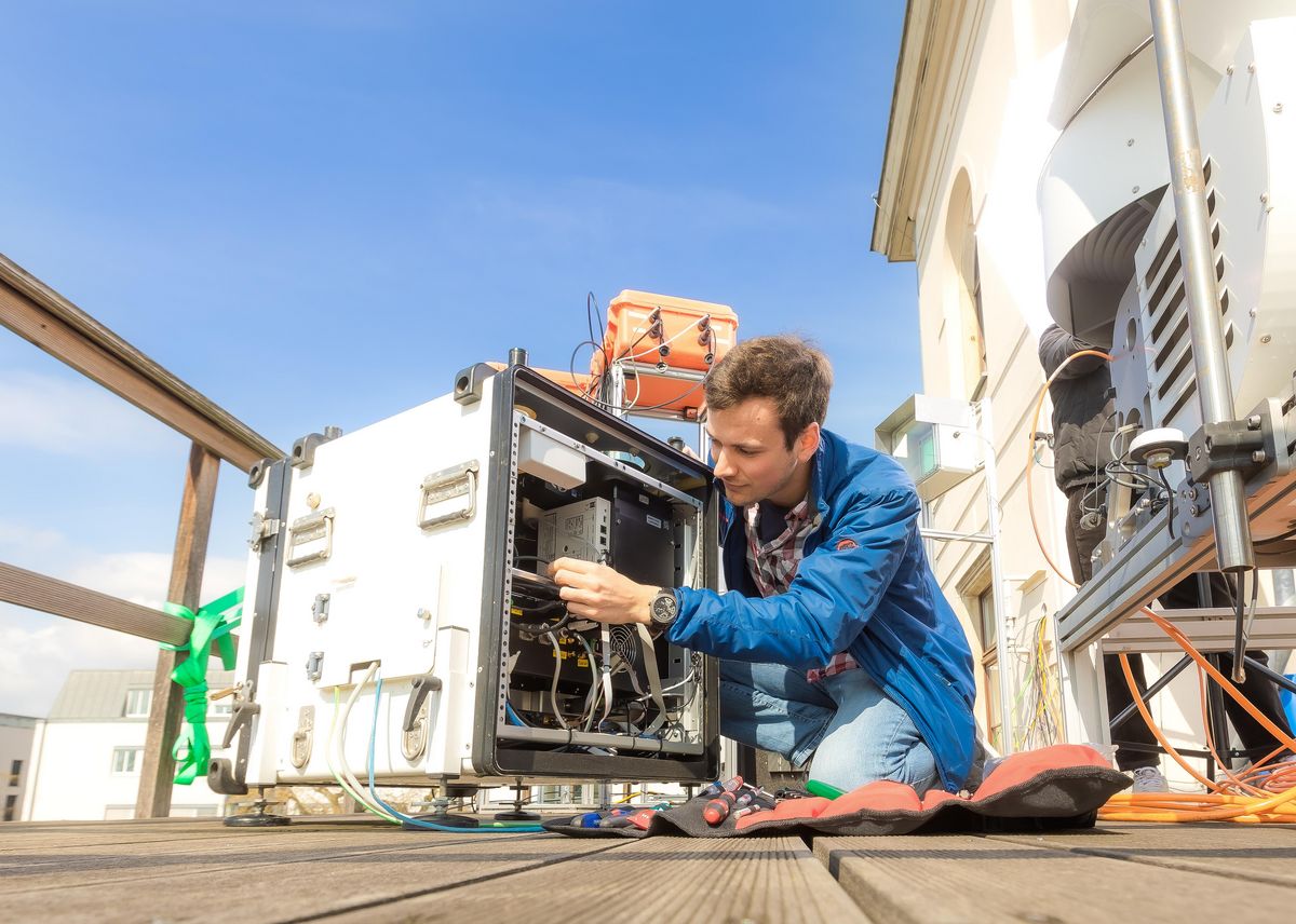
Ground-based remote sensing is a major tool to explore processes within the atmosphere over long time spans. Several different remote sensing methods are used in atmospheric science. They can be either active or passive. In active remote sensing radiation is emitted by the instrument. The receiver at the ground observes the amount of electromagnetic radiation. Passive remote sensing detects only radiation emitted by the Sun or the atmospheric components. Ground-based remote sensing measurements can be used to validate in-situ, airborne, and satellite-based observations.
Research Profile
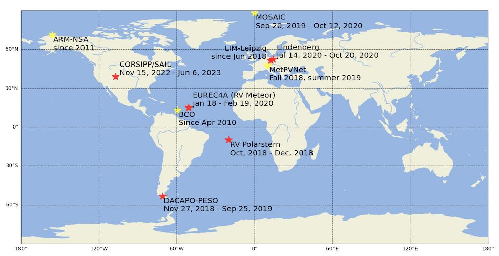
We focus mainly on combining different active and passive ground-based remote sensing instruments to get comprehensive profile information of the atmospheric state (temperature, water vapor, cloud microphysics and cloud dynamics, wind, precipitation) and for power predictions for renewable energy facilities. We use these state-of-the-art measurements to develop or improve atmospheric retrieval algorithms. For that purpose, we use sophisticated approaches like optimal estimation techniques and machine learning. Since our instruments are mobile, we deploy them in different regions of high interest around the globe, like the midlatitudes of the Southern Hemisphere, the trade wind region of the Caribbean, and in the future possibly also in the Arctic.
Research Interests
- Arctic Amplification
- Microphysics, dynamics, and radiative impact of clouds
- Synergystic profiling with remote sensing instruments for atmospheric research
- Atmospheric retrieval algorithm development
- Precipitation formation pathways
- Evaporation and sublimation of precipitation
- terrain
- Application of remote sensing observations for the improvement of renewable energy forecasts
- Interdisciplinary studies at the atmosphere-biosphere interface
INSTRUMENTATION
Several different remote sensing methods are used in atmospheric science, they can be either active or passive.
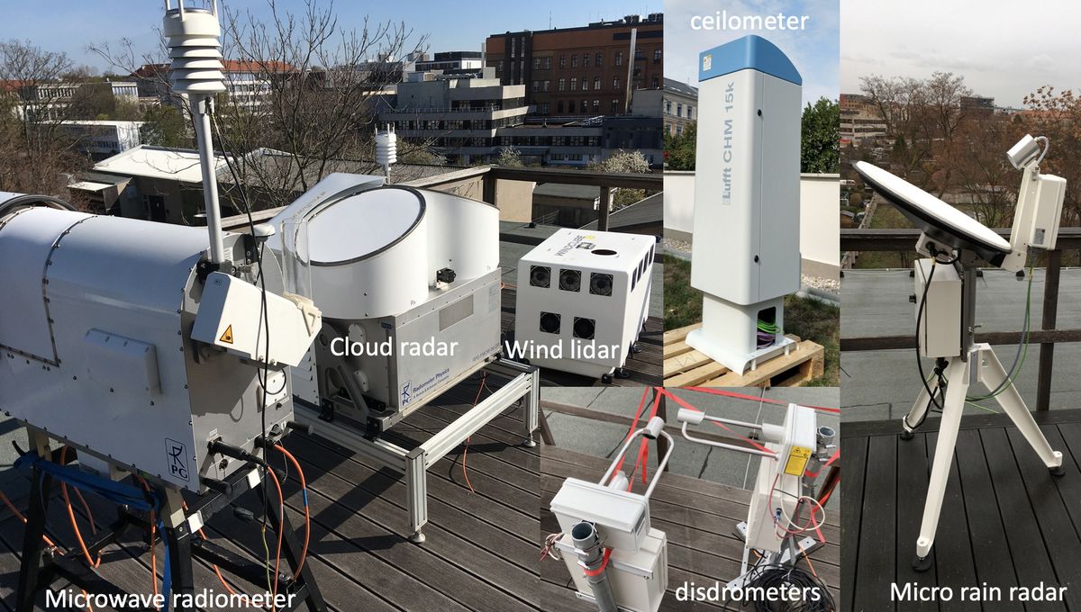
In active remote sensing (e.g., RADAR, LIDAR, SODAR) radiation is emitted by the instrument and the receiver at the ground observes the amount of electromagnetic radiation which is scattered or reflected by atmospheric constituents. Passive remote sensing (e.g., microwave radiometer) detects only radiation emitted by the Sun or the atmospheric components like water vapor, oxygen or trace gases. Ground-based remote sensing measurements can be used to validate in-situ, airborne, and satellite-based observations.
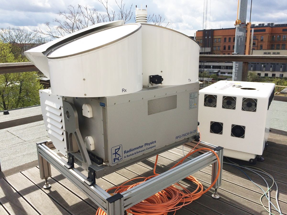
Since August 2023, our FMCW-94 GHz Doppler cloud radar LIMRAD94 has a scanner and can also be operated in a Radar Cardanic Mount .
Manufacturer: Radiometer Physics GmbH
Centre Frequency: 94 GHz (λ=3.19 mm) ± 100 MHz typical
IF range: 0.35 to 4.5 MHz
This radar was developed for atmospheric research. It operates at 3.2 millimeter wavelength which allows for reaching high sensitivity with small sizes of the instrument. The radar provides range profiles of parameters that contain information about scatterers in the atmosphere such as cloud particles, raindrops, snowflakes and insects. The radar utilizes frequency modulated continuous wave (FMCW) signals and therefore has high range resolution down to 1 m. Doppler and polarimetric (optional) capabilities of the radar make a good basis for a classification of particles and a quantitative characterization of hydrometeors.
Areas of Applications
- Calibration of precipitation and cloud radars including satellite-based systems
- Estimation of propagation effects for satellite links
- Precipitation and fog nowcast
- Hydrometeor classification
- Quantitative precipitation estimation
- Wind direction and speed retrieval
- Profiling of liquid water
- Microphysical analysis of clouds and precipitation
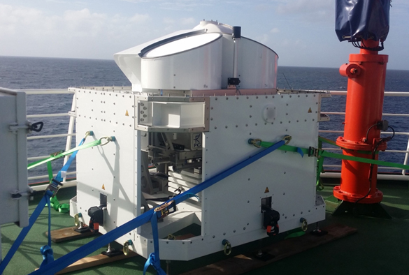
Radar Cardanic Mount for ship-based operation
Manufacturer: Radiometer Physics GmbH
The cloud radar horizontal stabilization platform of a cardanic-mount type is needed to assure zenith-pointing of the instrument during operation on research vessels despite wave action. Stabilization of the radar is required to eliminate the effect of horizontal wind on the radar Doppler velocities. We have successfully tested this prototype platform during the field experiment EUREC4A.
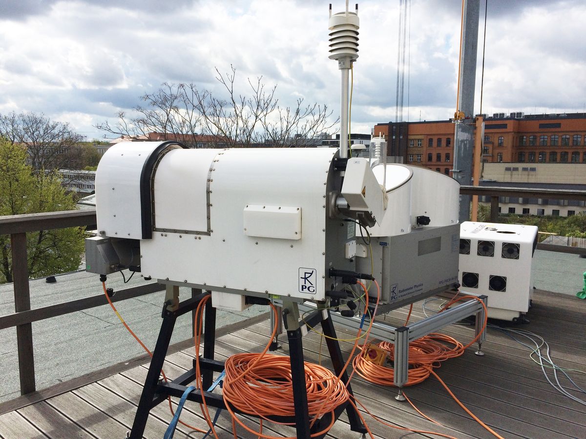
Radarscanner
Manufacturer: Radiometer Physics GmbH
In August 2023 a prototype cold-temperature radar scanning unit was acquired to allow for full polarimetric observations with the radar. We have successfully tested this scanning unit during the field experiment CORSIPP.
Manufacturer: Radiometer Physics GmbH
Operating frequencies: 22 – 31 GHz and 51 – 58 GHz
Applications
HATPRO is mainly used to derive
- vertical profiles of humidity,
- temperature,
- integrated water vapour (IWV), and
- liquid water path (LWP) during non-precipitating conditions.
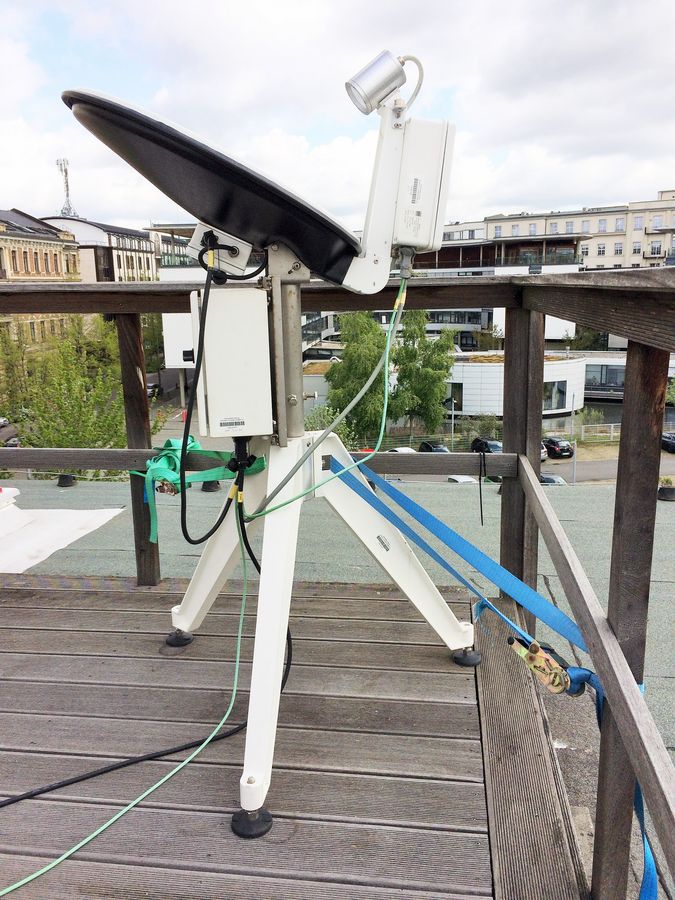
Manufacturer: METEK Meteorologische Messtechnik GmbH
Operating frequency: 24 GHz
Applications
The Micro Rain Radar MRR operating at 24 GHz is a unique meteorological radar profiler for Doppler spectra of hydrometeors in height ranges 15 m – 6000 m. The high resolution in time and height enables the MRR to monitor the genesis of frozen hydrometeors, the melting zone (bright band) and the formation of rain drops. It provides profiles of droplet size distribution, mean Doppler velocities and mean volume diameter from which rain rates are derived.
Manufacturer: GWU Umweltechnik GmbH
operating wavelength: 1.54 μm, observation of the boundary layer up to 500 m
Application
The Leosphere Windcube is a compact Doppler lidar instrument for observations in the lower part of the boundary layer (up to 500 m). The Doppler lidar technique utilizes small aerosol particles with negligible terminal fall velocity as air motion tracer. The velocity of these particles is similar to the wind velocity. Therefore a 3D profile of wind speed and direction can be derived wherever enough tracer particles are available. Due to their compact sizes most Doppler lidar instruments are easily deployed in field experiments. Additionally, energy companies use wind profiles from Doppler lidar measurements for evaluations of potential wind energy facility deployment sites.
Manufacturer: Lufft GmbH
Operating wavelength: 1.064 nm
Application
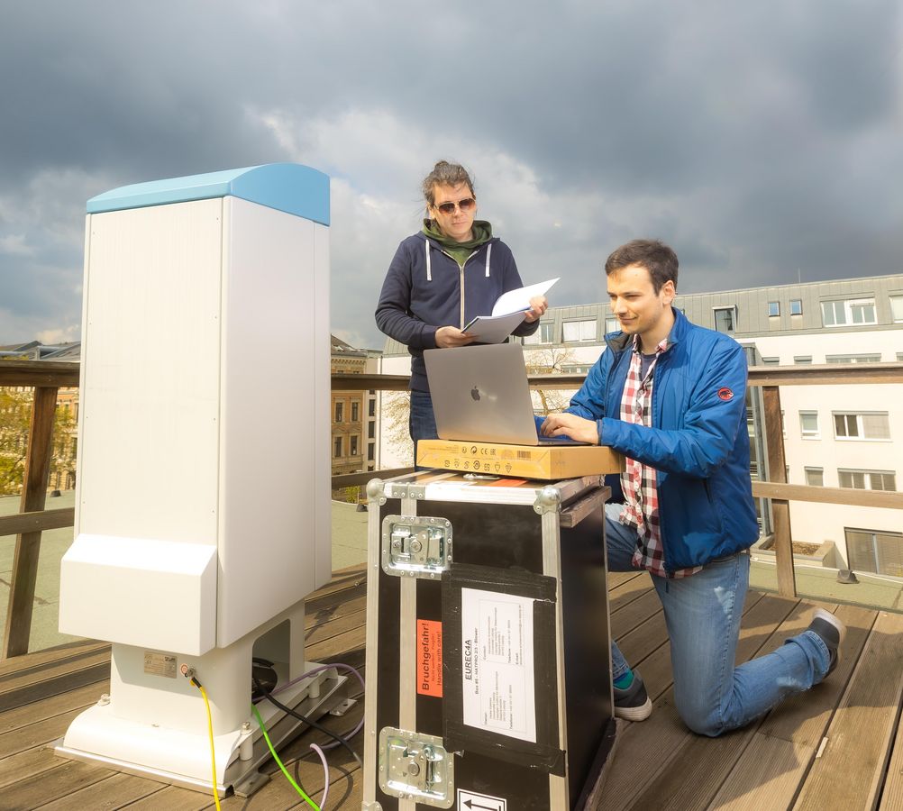
The ceilometer is a simple compact, eyesafe lidar profiling the atmosphere from the surface to up to 15 km. It is the newest addition to our instrument suite (Sep 2020) and will be used for research and teaching (the latter within the advanced practical lab (“Fortgeschrittenpraktikum”). Based on the observation of vertical profiles of particle backscatter coefficients, the altitude of fog, aerosol layers, and clouds can be detected.
Manufacturer: Thies Clima
Operating wavelength: infrared, 785nm
Application
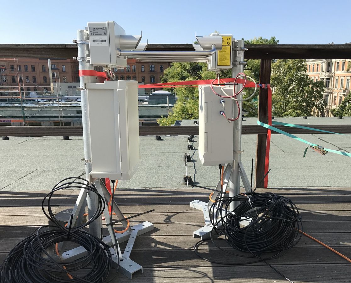
The Laser-Precipitation-Monitor by the Thies Clima Company is used for the optical measurement of precipitation particles.
The determination of fall velocity and size of rain drops or ice crystals is realized by shadowing of a laser beam. While a hydrometeor is falling through the beam only a reduced signal reaches the receiver. The duration of the shadowing gives information about the fall velocity while the amplitude of the shadowing is used to determine the particle diameter. Thus, the spectra of these two quantities is derivable, as well as the precipitation intensity, radar reflectivity and the type of precipitation (e.g. drizzle, rain, hail, snow).
